The purpose of this study is to draw people’s attention back to the significant problem of agricultural loss, in order to imagine the possibilities of the future agricultural settlement pattern and further connect the city to the country through the new settlement pattern.

Site
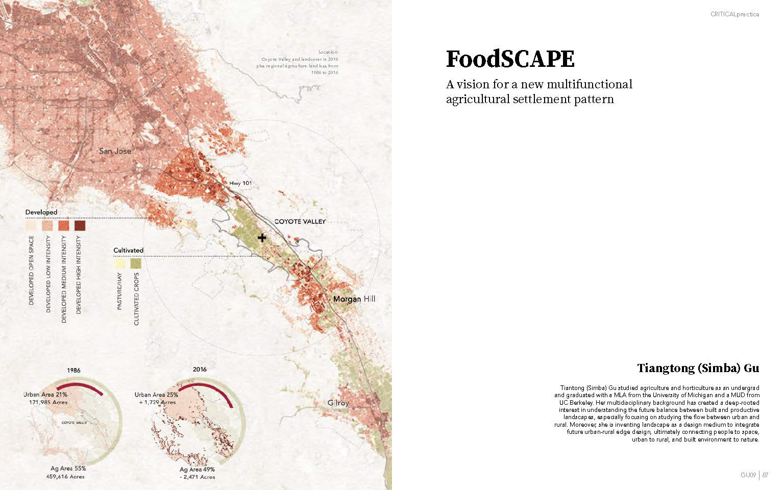
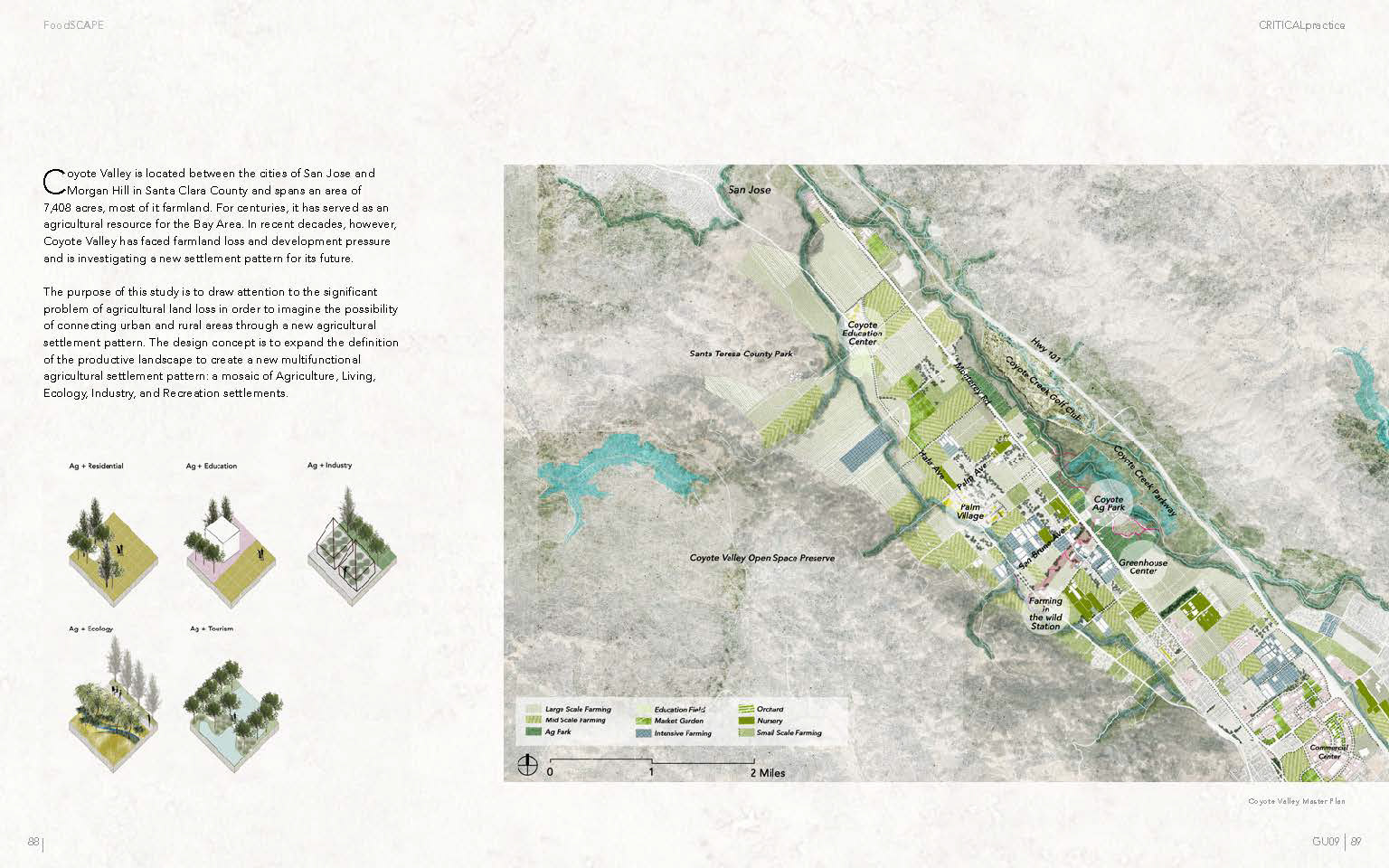
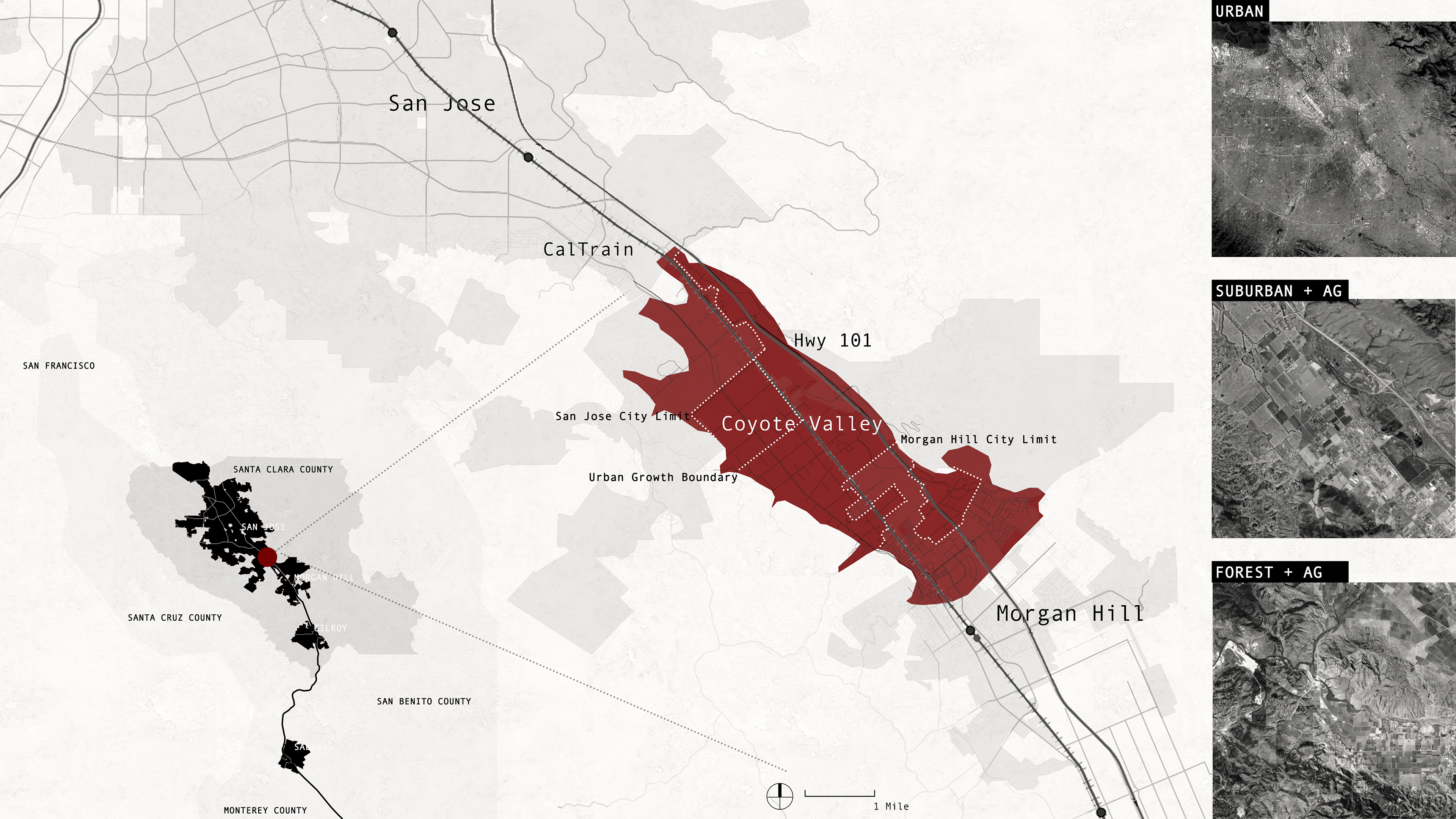
The Coyote Valley is located between the City of San Jose and the City of Morgan Hill in the Santa Clara Valley, with an area of 7,408 acres, most of it farmland. For centuries, it serves as an agricultural resource for the Bay Area, however, in recent decades the Coyote Valley is facing farmland loss and development pressure, and has looked into a new settlement pattern for its future.
Location
Landcover Change 1986-2016
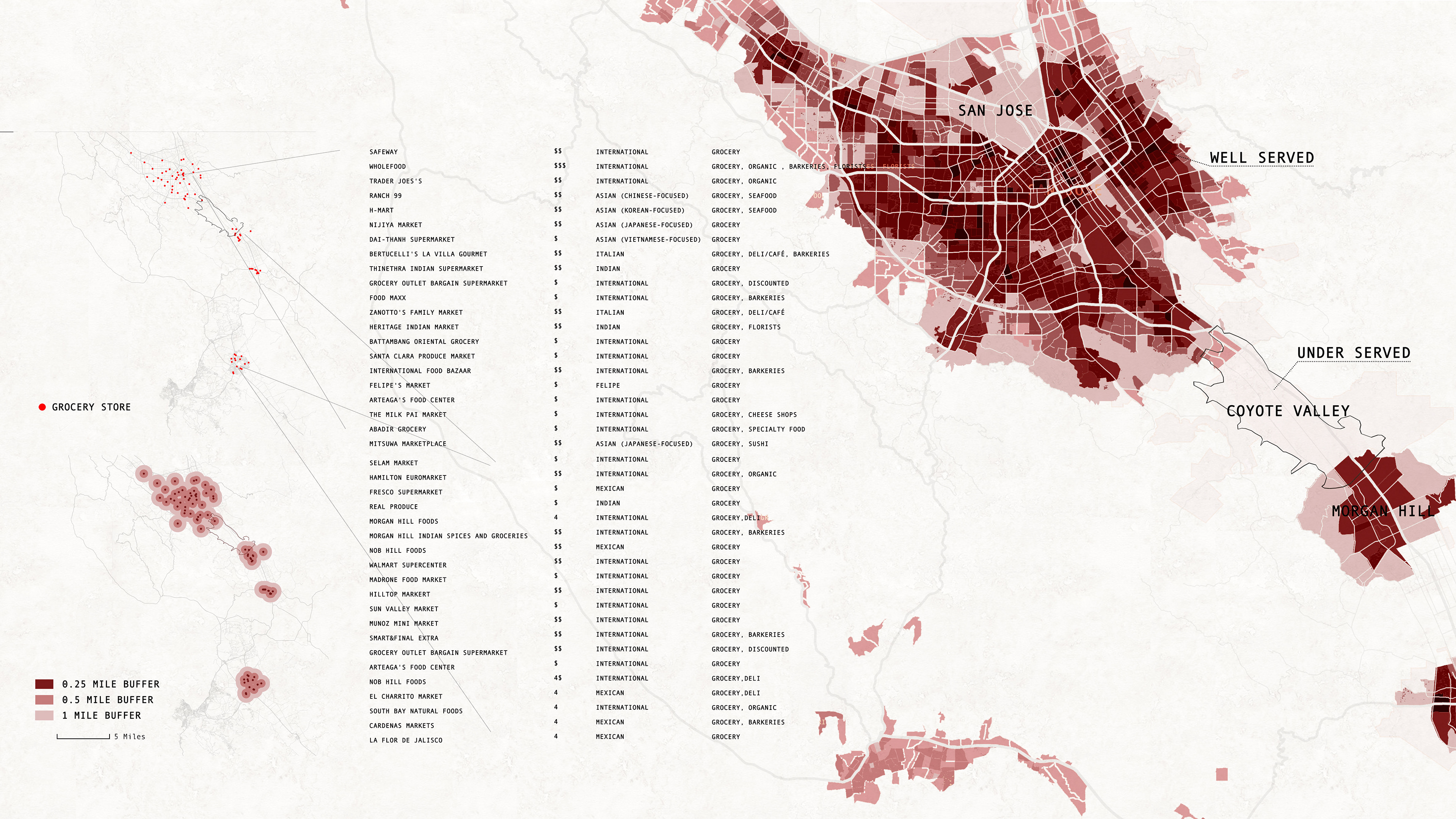
Food Accessibility
Ideology Development
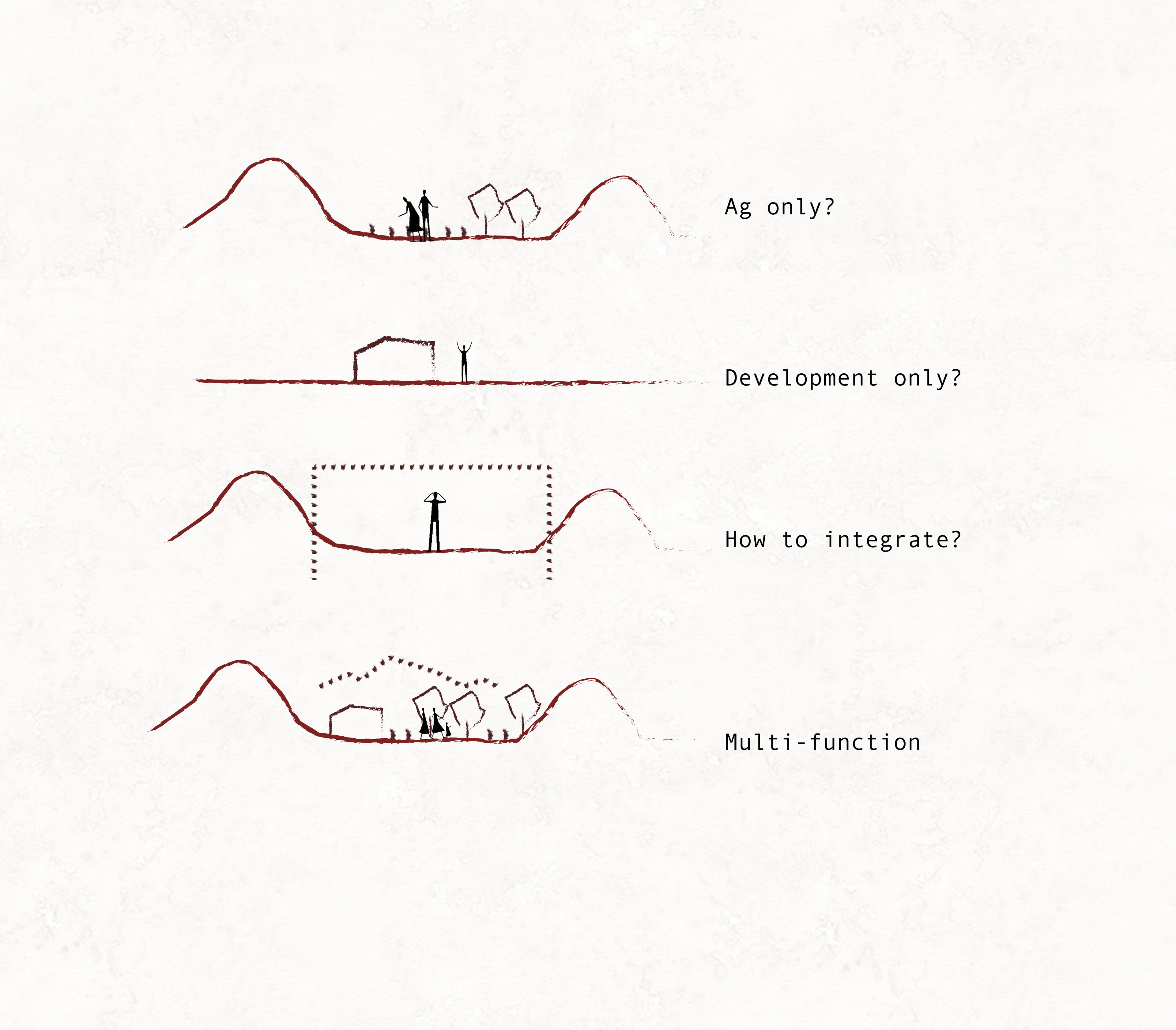
The idea of integrating productive landscape into Multi-functional Agricultural Settlement Pattern originated from the attention to Urban Agriculture(UA). UA starts to raise up as the population is booming. However, as most literature stated that urban agriculture is not drawing attention to the inexorable loss of farming land near cities due to urban sprawl, it is primarily a social initiative but will not be a solution to food problems, while traditional farming is still a requirement for the future population. Attention to a rural area is still required. As I studied the existing agriculture typologies from urban to rural areas, I found all of these typologies, not only producing food but also serving as landscapes. So I came up with an idea of expanding the definition of the productive landscape to indicate a new multi-functional agricultural settlement landscape, which is a mosaic of Agriculture, Living, Ecology, Industry, and Recreation.
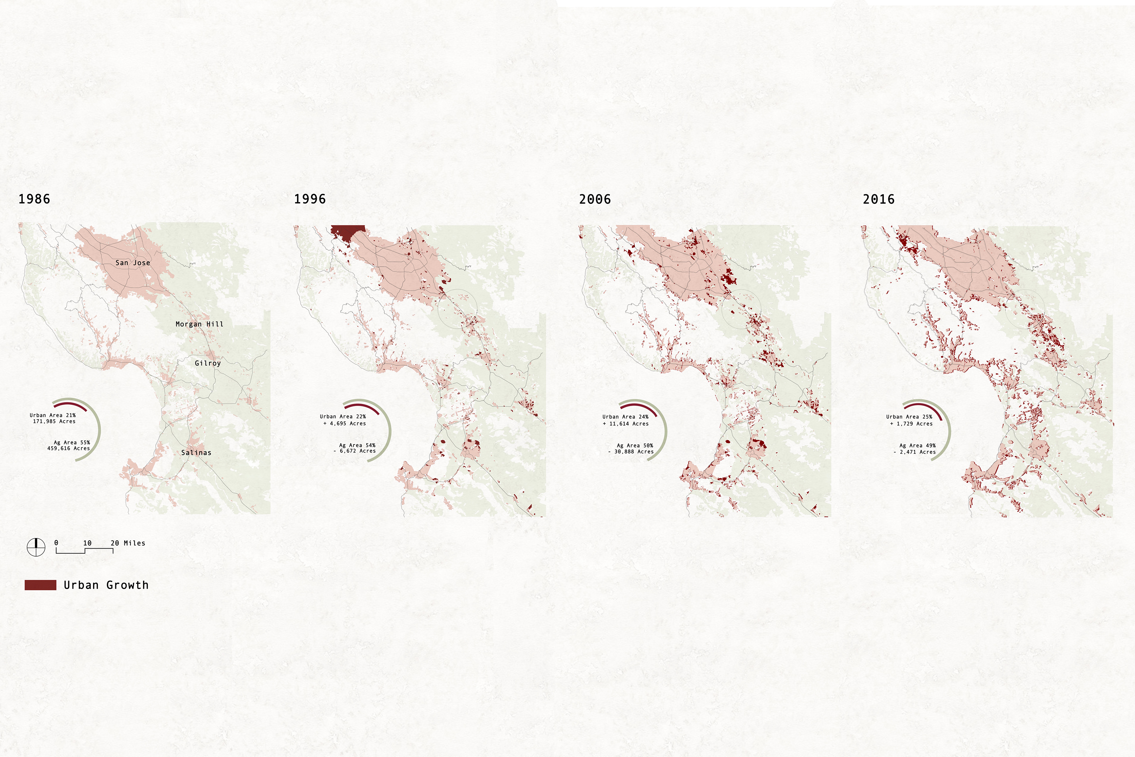
Sprawl has been so widely seen in the past few decades of Santa Clara County’s landscape conversion. The county’s expansive farmlands largely have been paved over to create office parks and residential subdivisions.50% of the Coyote Valley areas are under the sprawl challenge and under the city of San Jose and Morgan Hill influence. The future of Coyote Valley needs not to be consumed by sprawl. The map is showing urbanized, un-urbanized areas, and areas under development pressure, also the policy framework map.
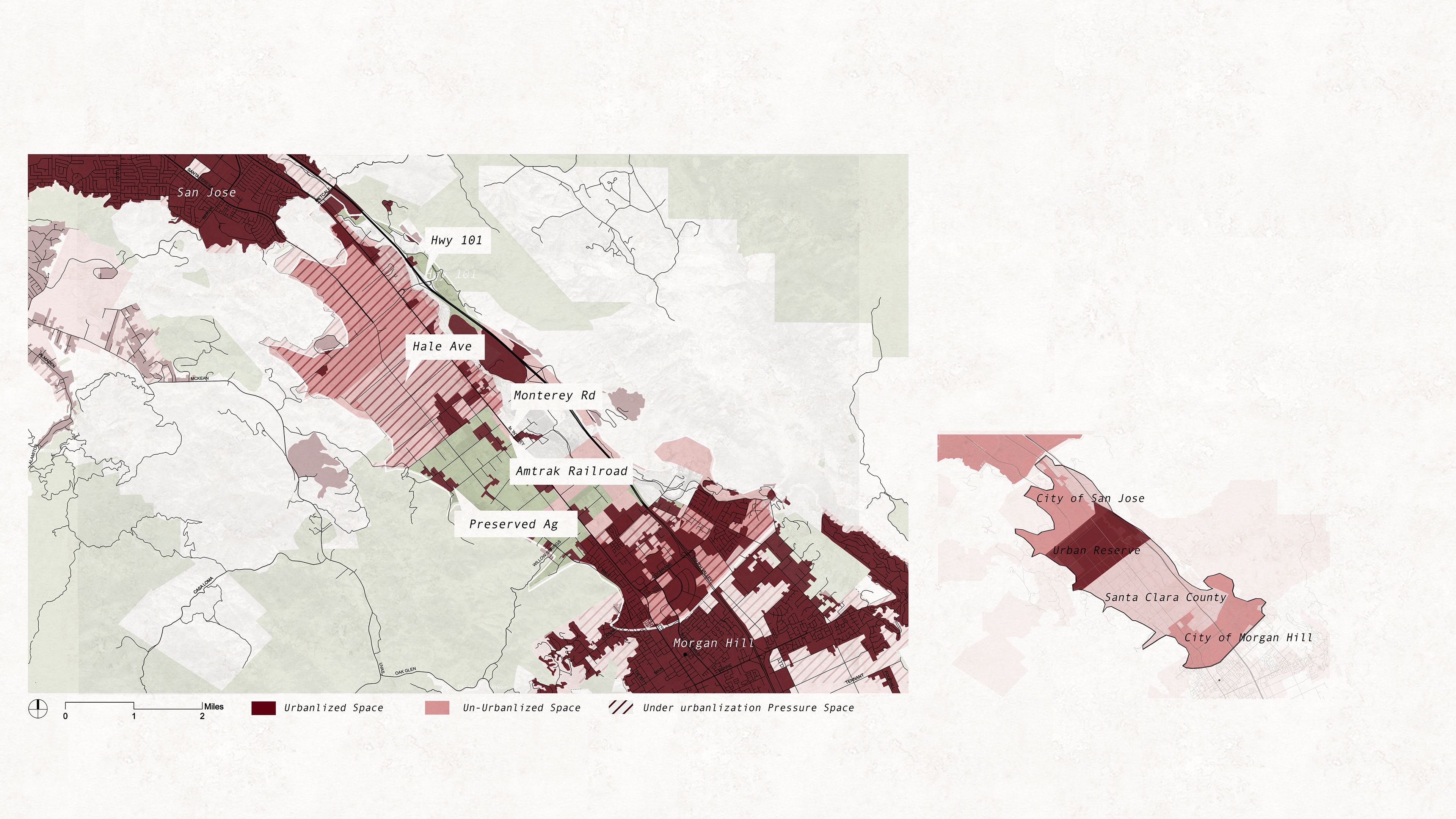
Policy Map
Soil
The rich soil in Coyote Valley makes it a perfect place for farmland. Coyote Valley is dominated by soils characterized as Prime with several areas in the northern section and southwestern section designated as being excellent for agricultural activities. Soils along the northeastern edge are classified as loam or silt loam, which is generally designated for grazing.
Crop Types and Values
Based on the mapping overlay of parcel sizes, crop types, and crop value made per acres, the majority of acres in the Valley are dedicated to low-value crops, with 80 percent of estimated harvested acres in field crops (hay, pasture, and range). 57 percent of estimated harvested acres in the Valley are dedicated to hay and pasture. However, these crops can make up only two percent of the Valley’s agricultural value. While some small pockets of the Valley are experiencing investment in high-value crops, like cherry, mushrooms. However, Given an urban growth scenario, the return on investment for high-value crops is far less than the value of selling the land for urban development. It is likely that landowners convey the agricultural use land to non-agricultural use in order to receive higher profits.
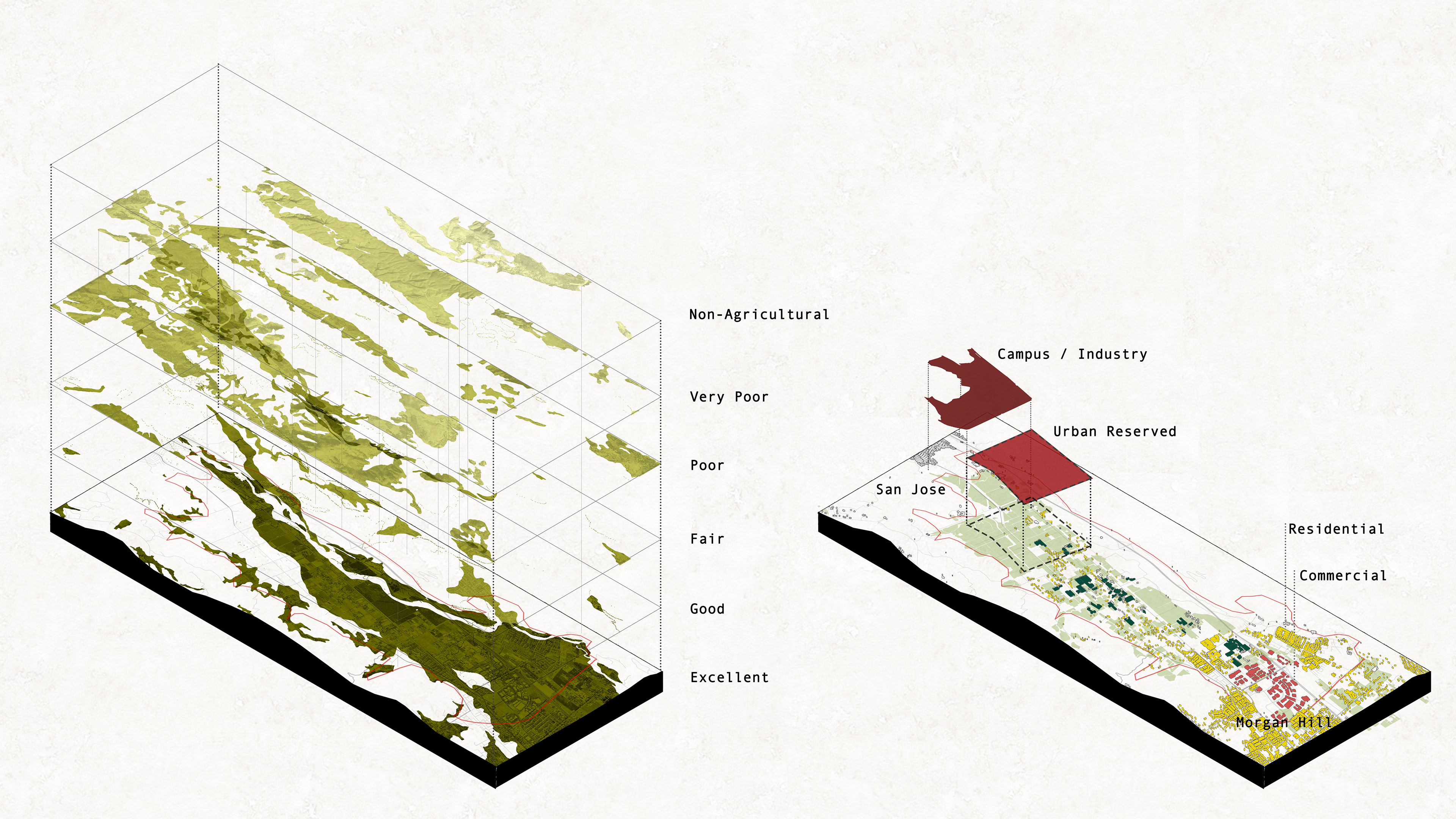
Soil and Land Use
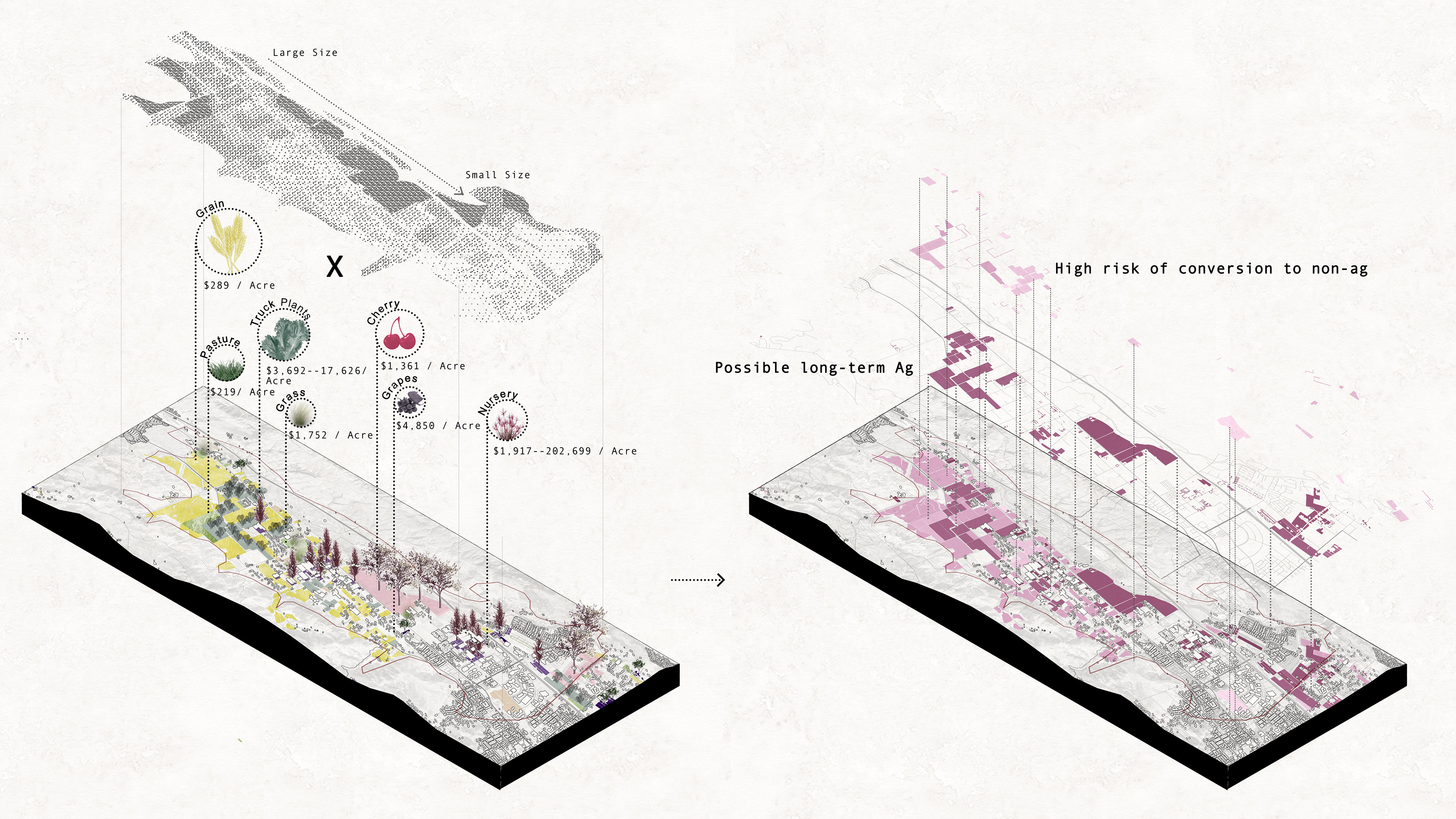
Crops Types and Values
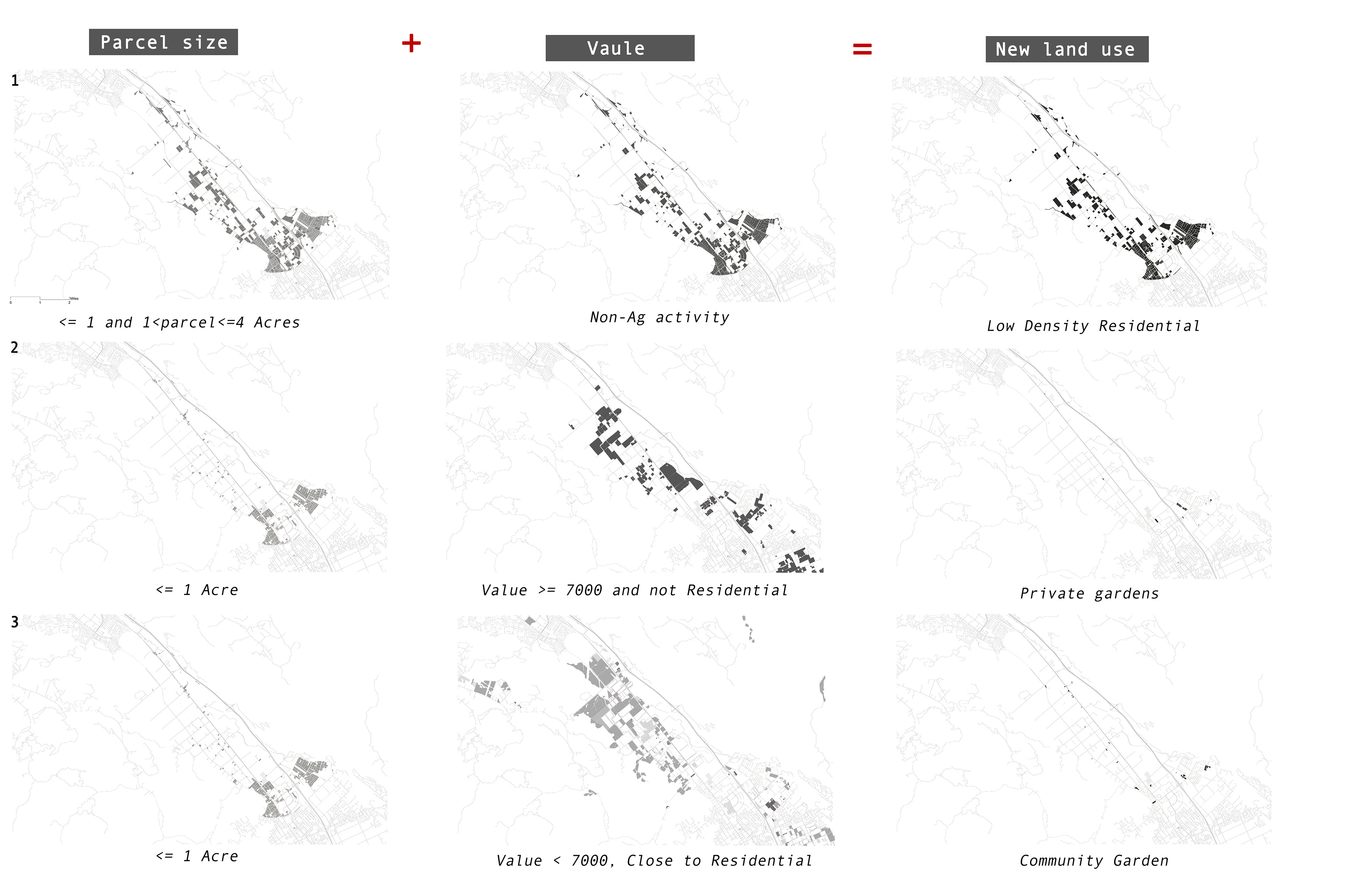
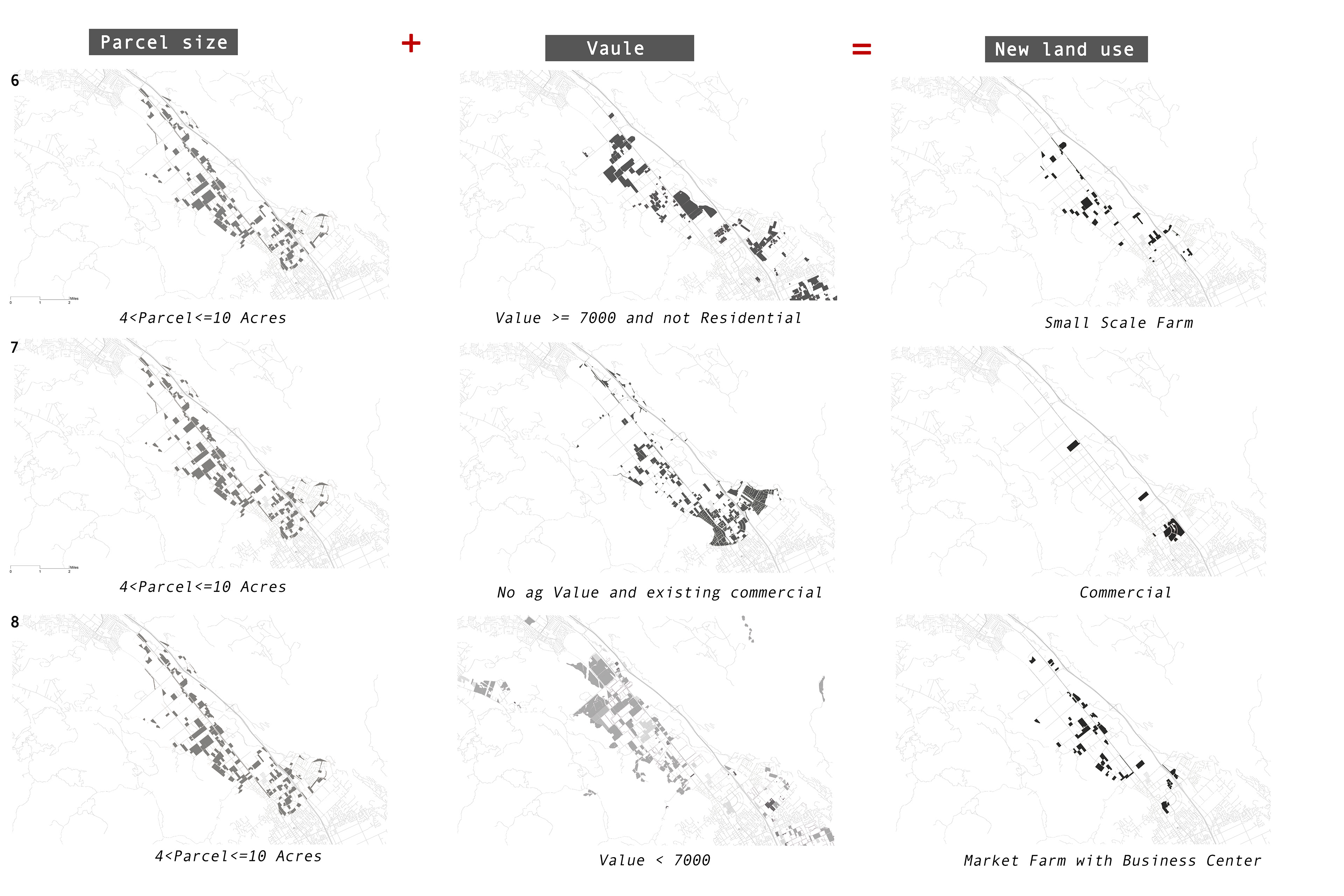
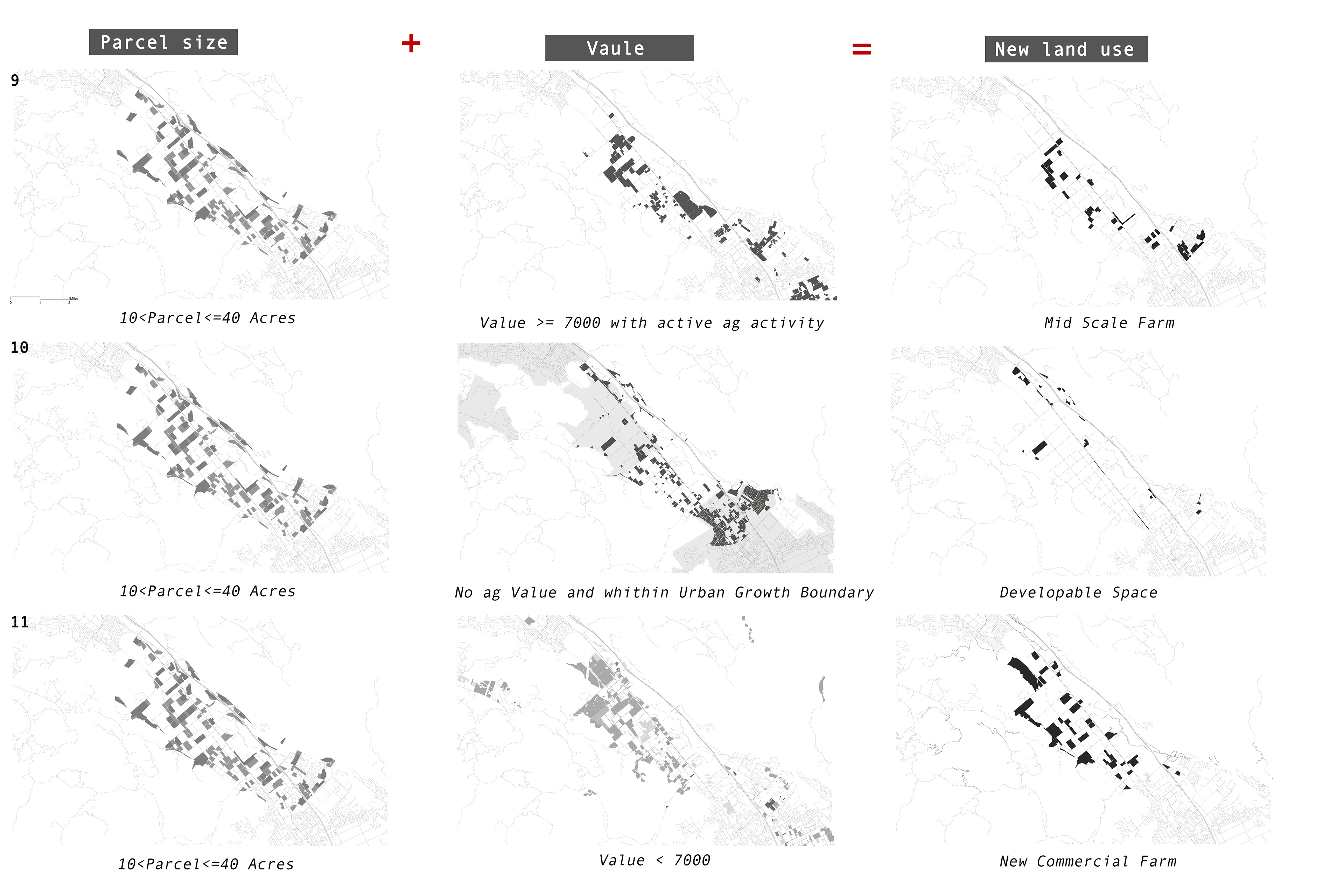
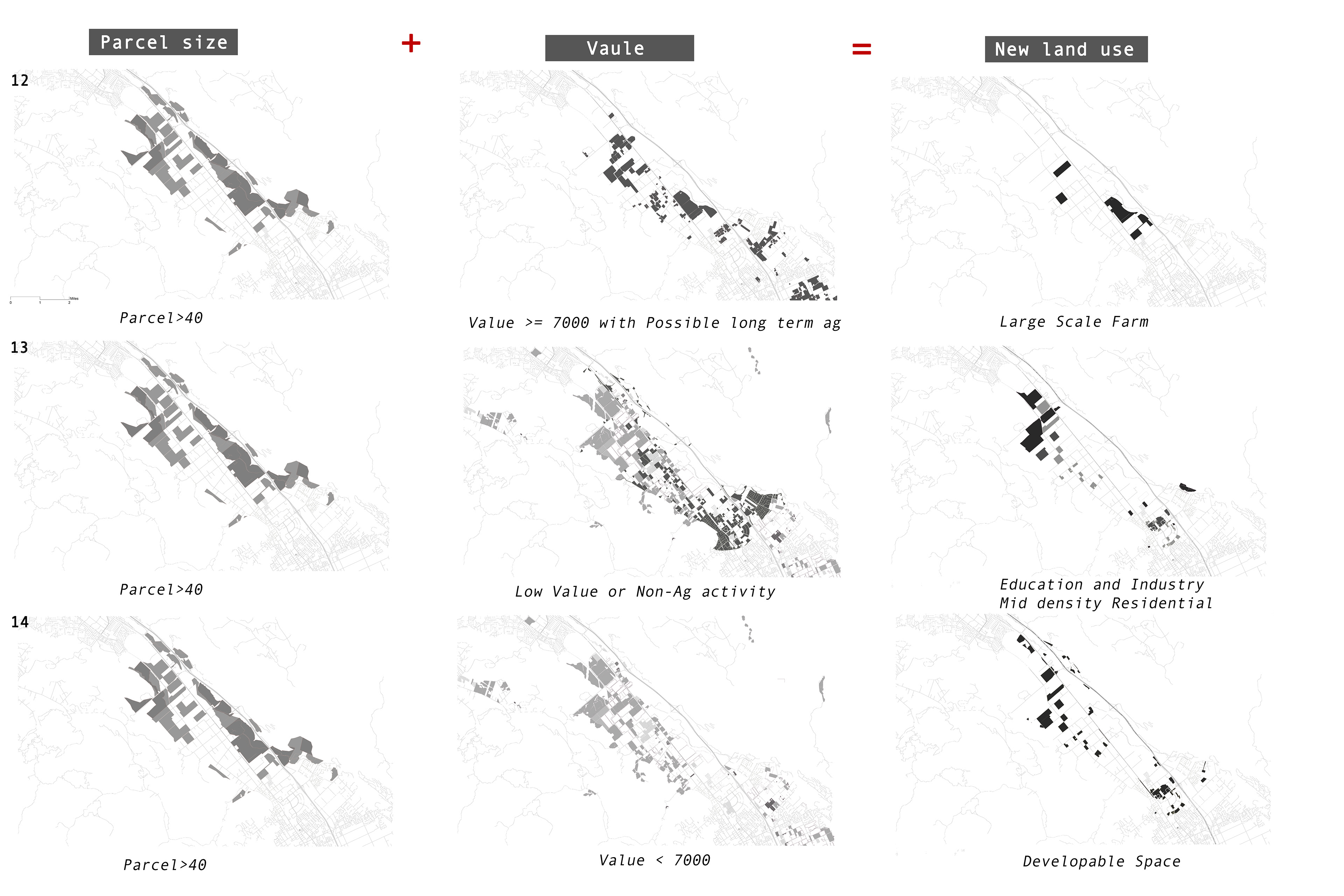
The process shown above, based on the parcel sizes, values of crops made, and existing land use patterns. Based on existing parcels, I categorized them into 5 zones, less than 1 acre, between 1 to 4 acres, between 4 to 10 acres, between 10 to 4o acres, larger than 40 acres. Then overlaid with the crops values maps that indicate low and high-value parcels.
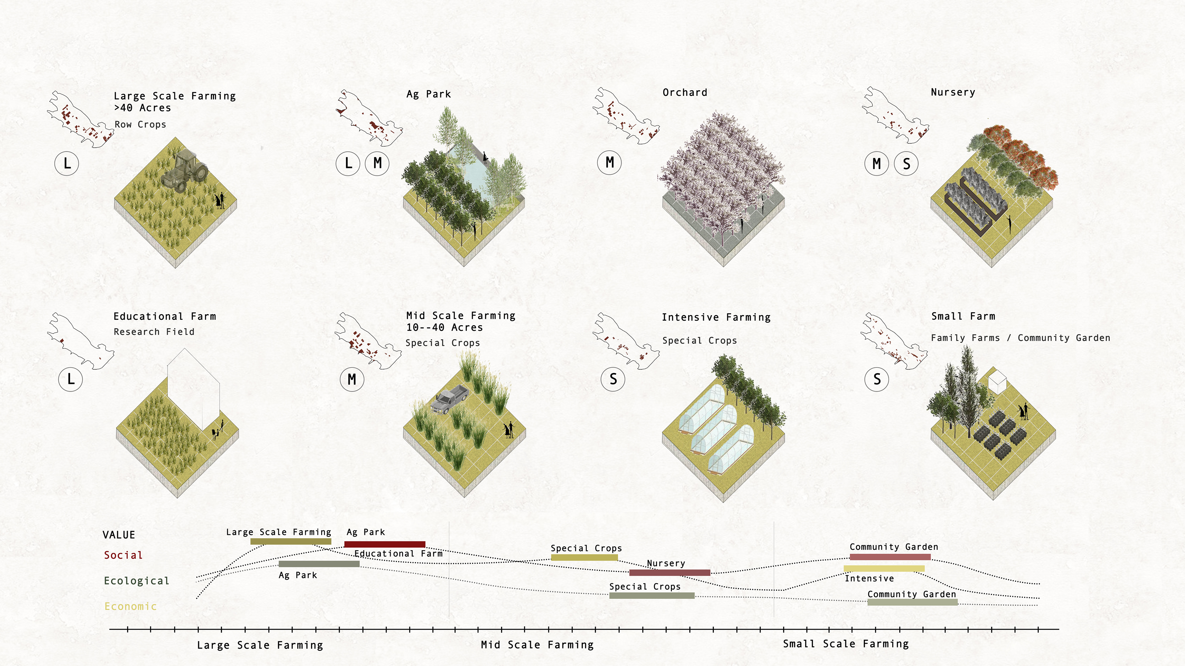
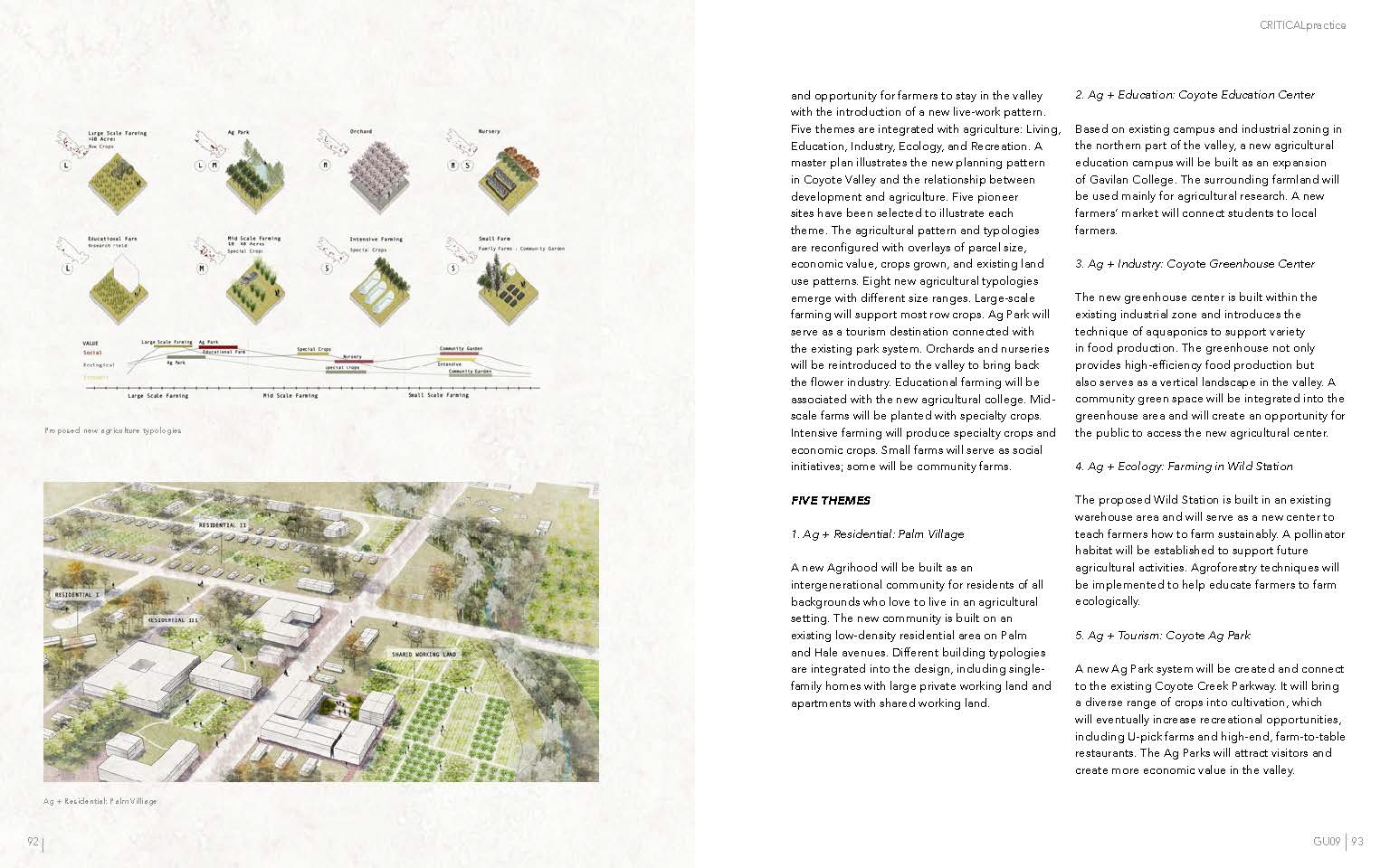
Productive Typologies
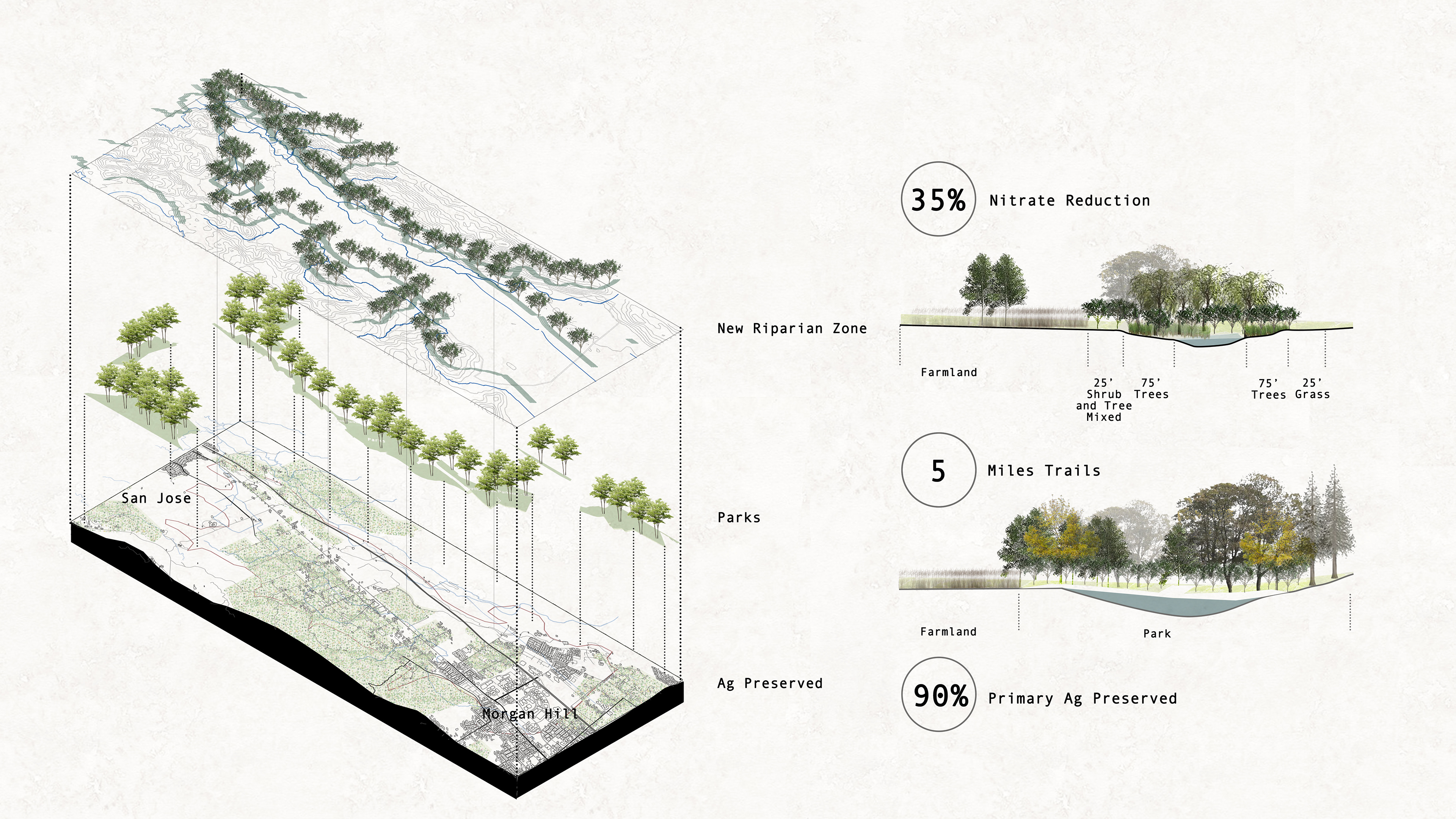
New Open Space System
Integrate agriculture with an open space system to create a New Green Belt system for Coyote Valley. A New 100’ riparian zone will be created along Coyote Creek and Fisher Creek. Trail systems will be reconnected into parks and agriculture areas.
Five themes
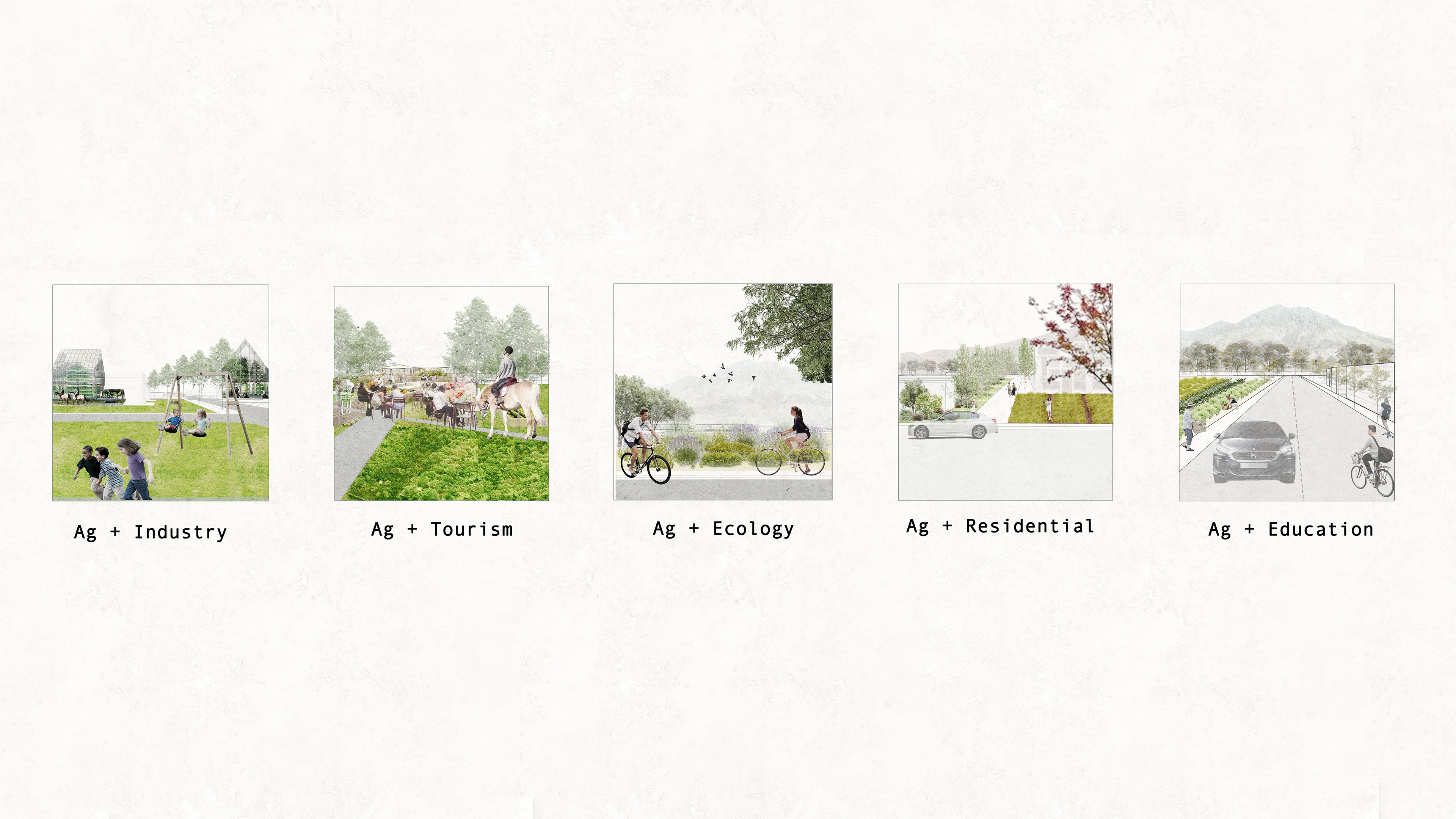
Five themes to Mosaic of Agriculture, Living, Ecology, Industry, and Recreation, as diagrams shown below.
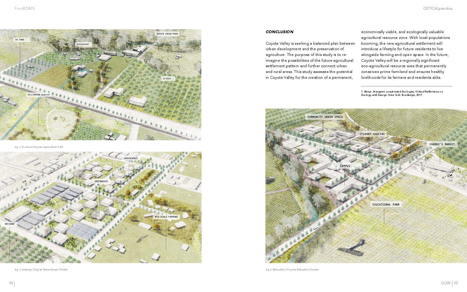
Ag + Industry: In order to ensure the food supply for the bay area, more intensive farming will be added into the space. The new food industry will include a greenhouse, aquaponics systems. It will also create an opportunity for the public to access the new agriculture production. A community green space will be created as well.
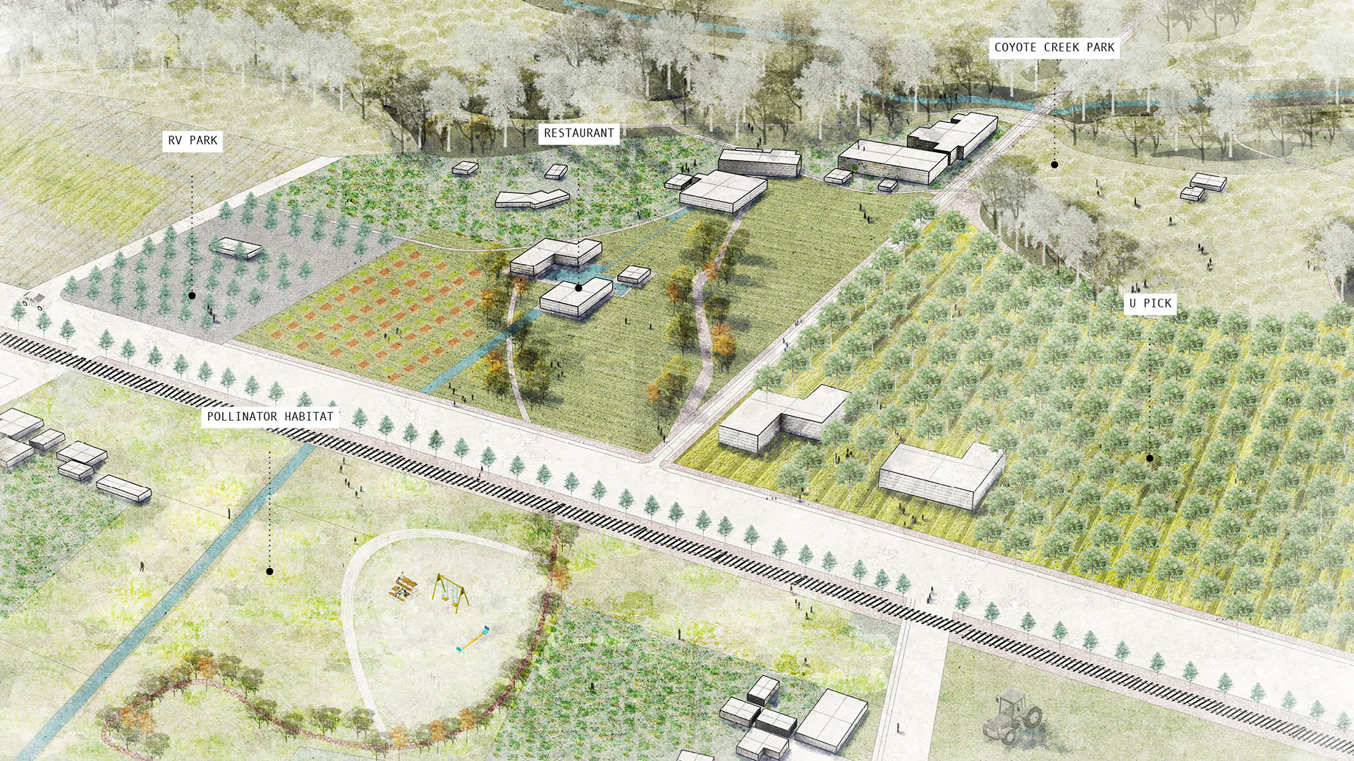
Ag + Tourism: A new Ag park will be built to expand the existing park system and provide more recreation opportunities.
Ag + Ecology: A pollinator habitat will be established to support future agriculture activities. Agroforestry will be formed to help educate farmers to farm ecologically.
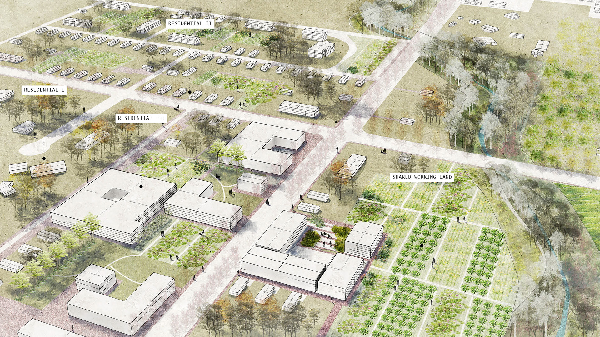
Ag + Residential: The idea is to make a new Aagrihood as an intergenerational community for residents of all backgrounds and love to live in an agricultural setting. By providing different building typologies including single-family homes and large private working land, and shared working land with apartment living styles.
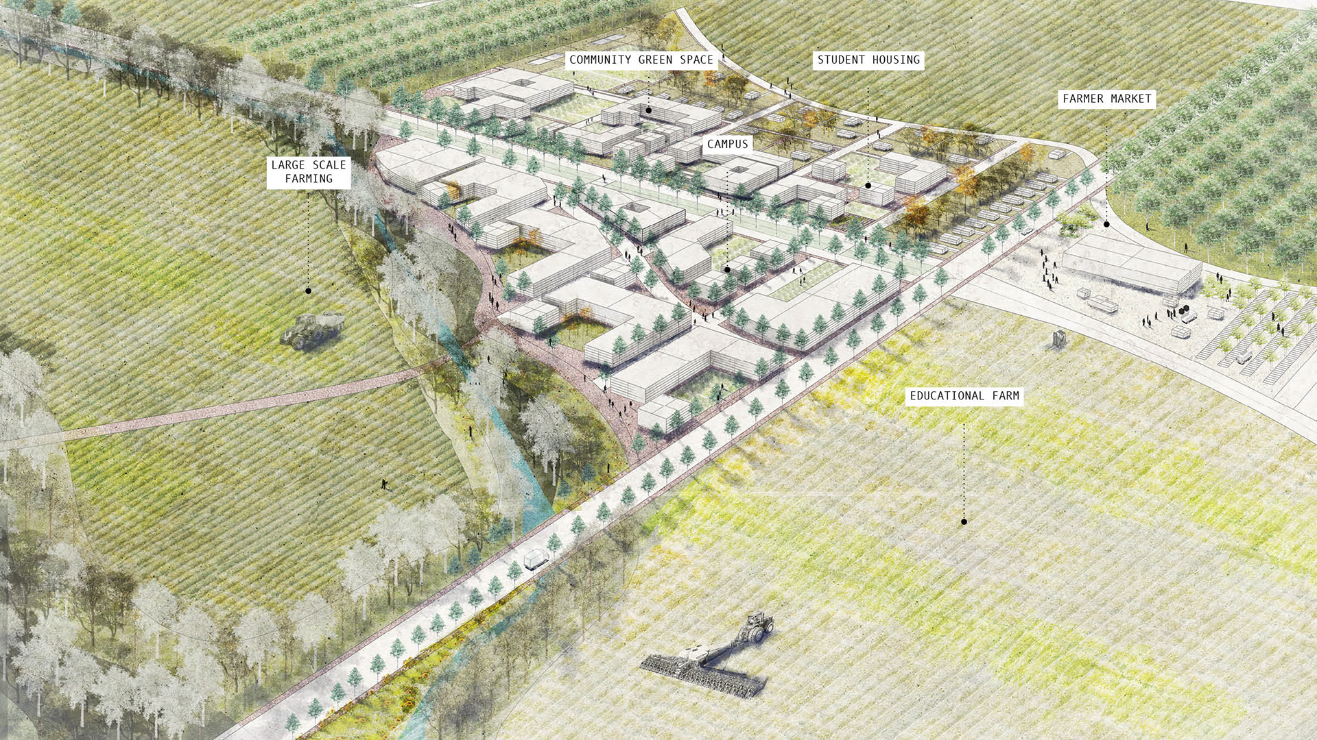
Ag + Education: Based on the existing campus and industrial zoning in the northern valley, a new agriculture education campus will be built as an expansion of Gavilan College. The surrounding farmland will be mainly for agriculture research.
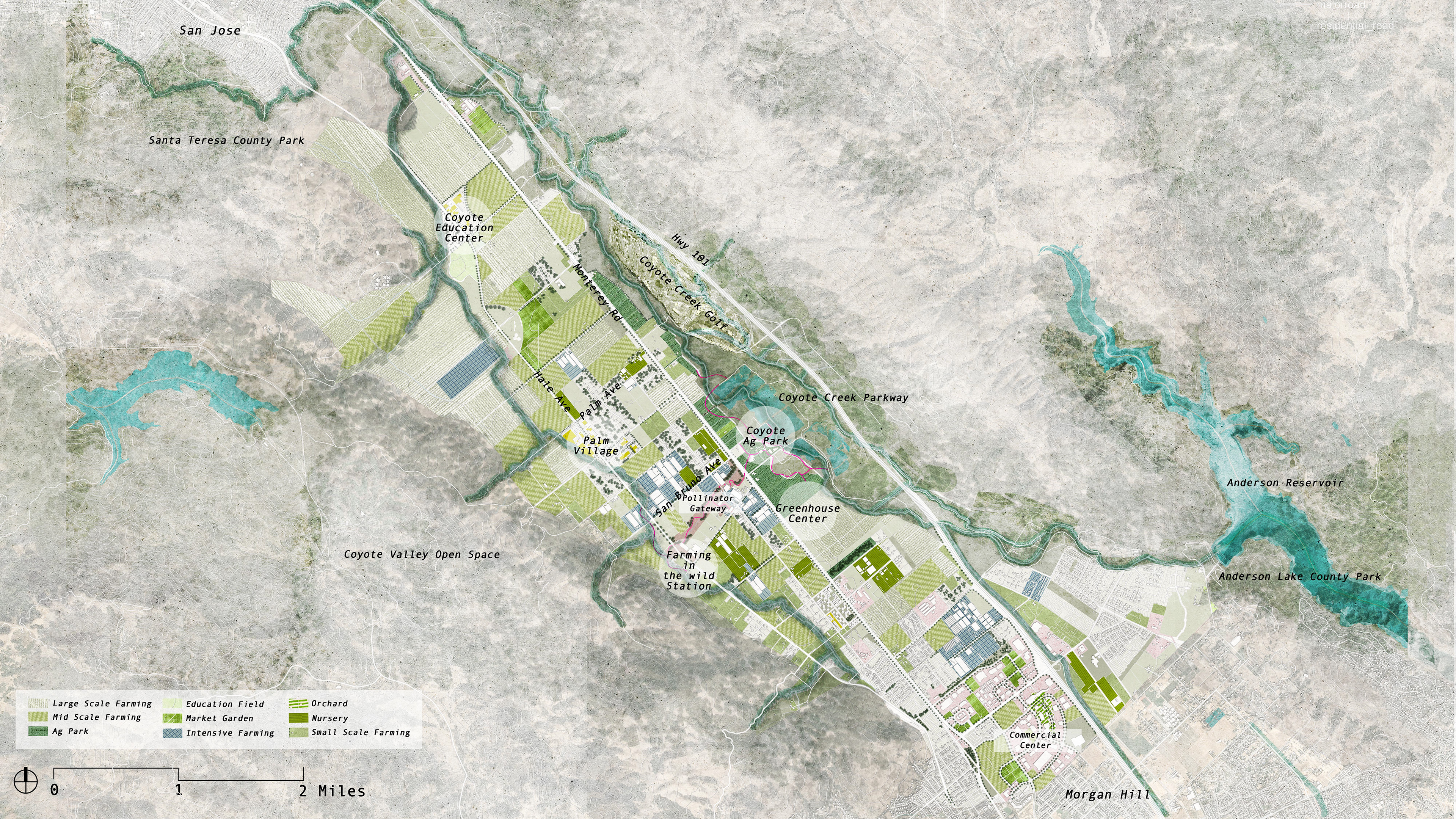
Master Plan

1. AG + Education
Coyote Education Center

Educational Productive Landscape

Detailed plan -- Ag + Education
2. AG + Residential
Palm Village
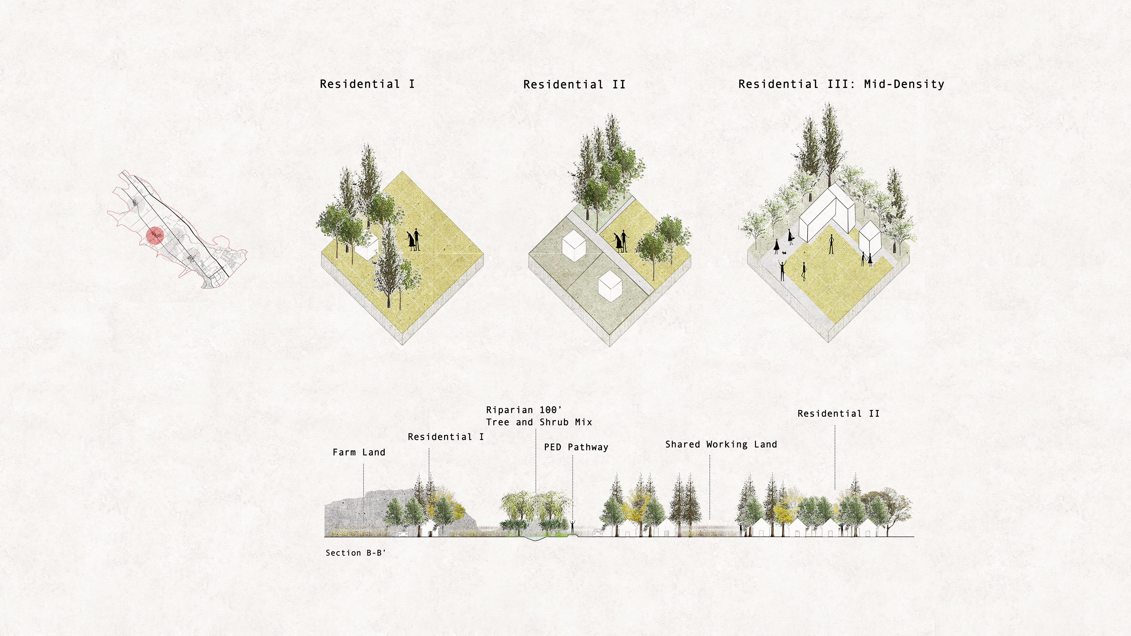
Residential Productive Landscape
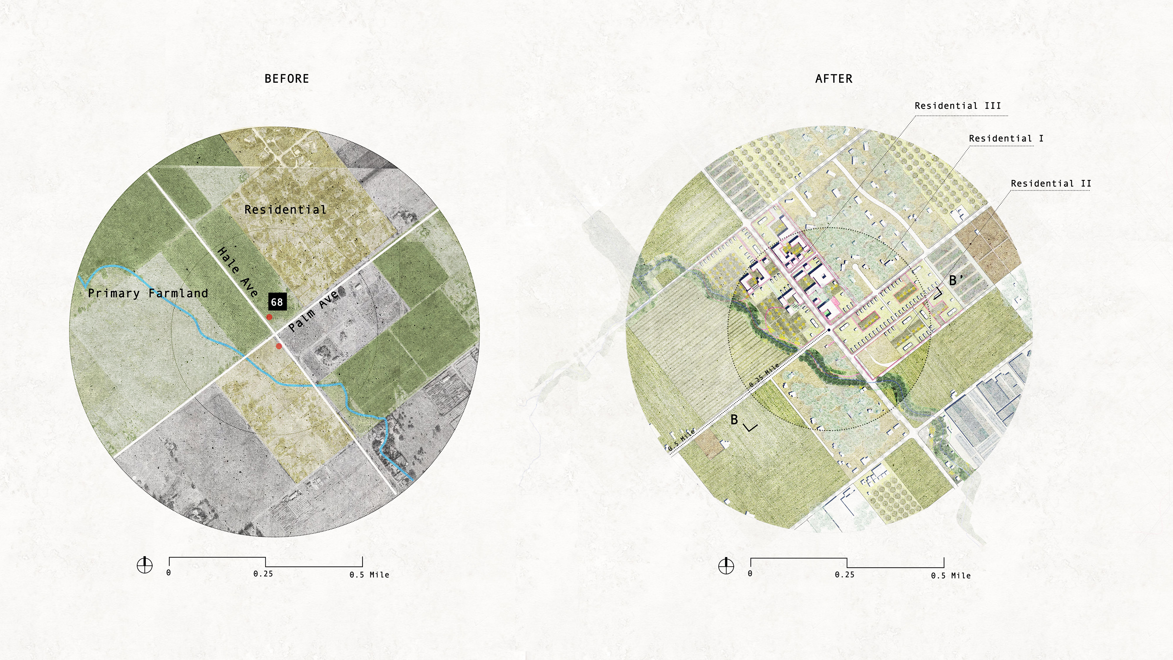
Detailed Plan -- Ag + Residential
3. AG + Industry
Greenhouse Center
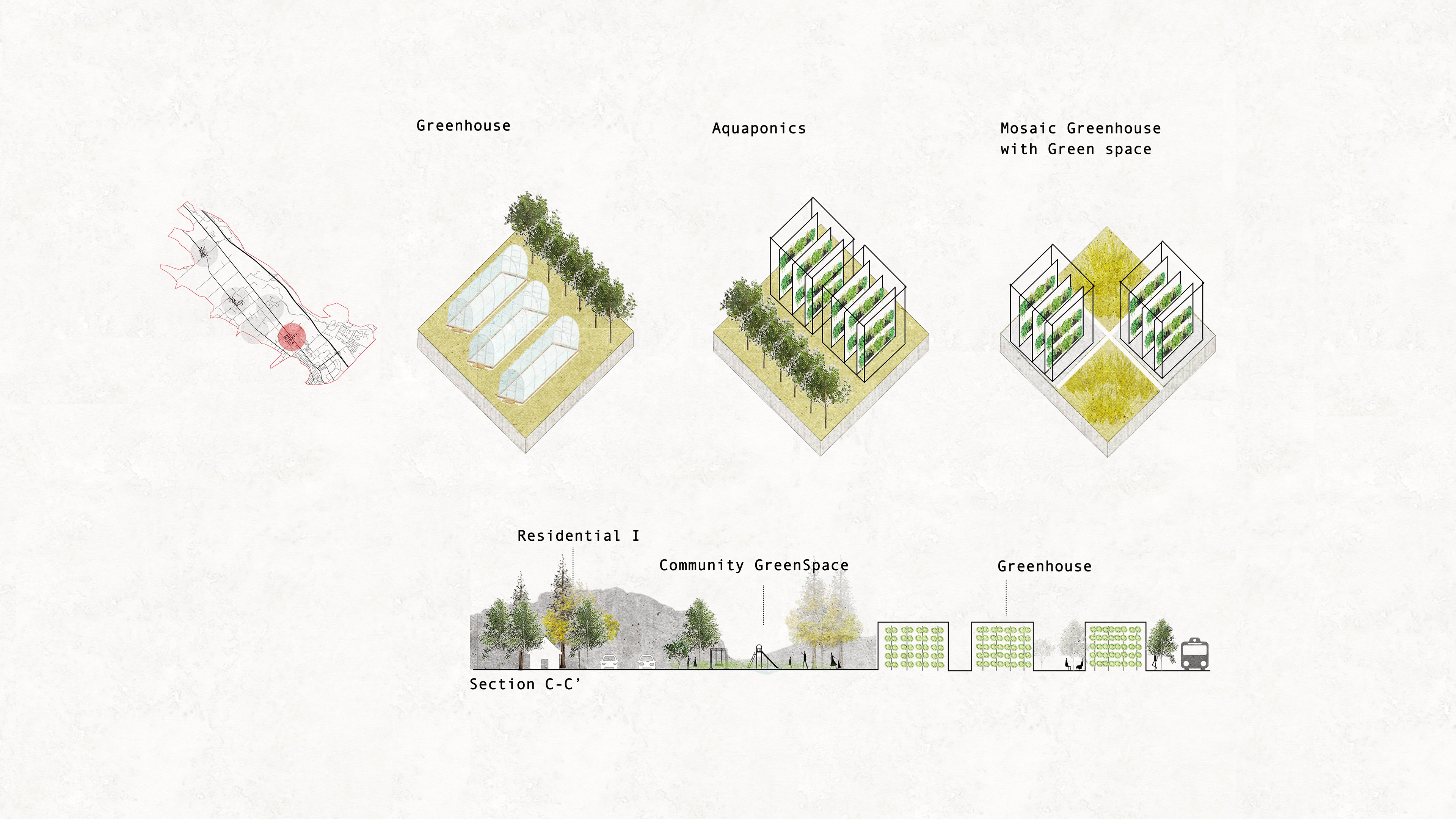
Industry Productive Landscape
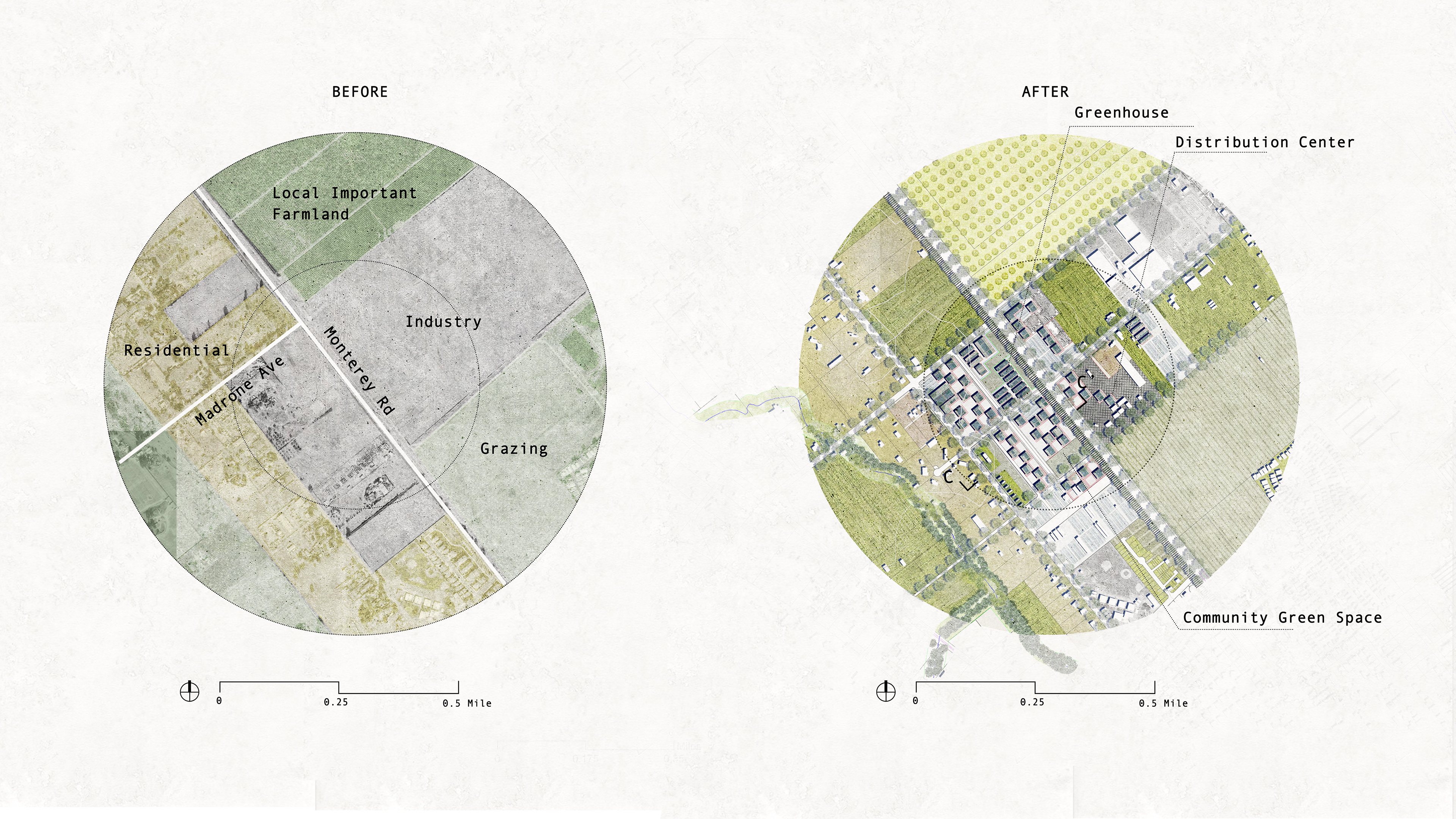
Detailed Plan -- Ag + Industry

4. AG + Ecology
Farming in the Wild Station

Ecological Productive Landsacpe
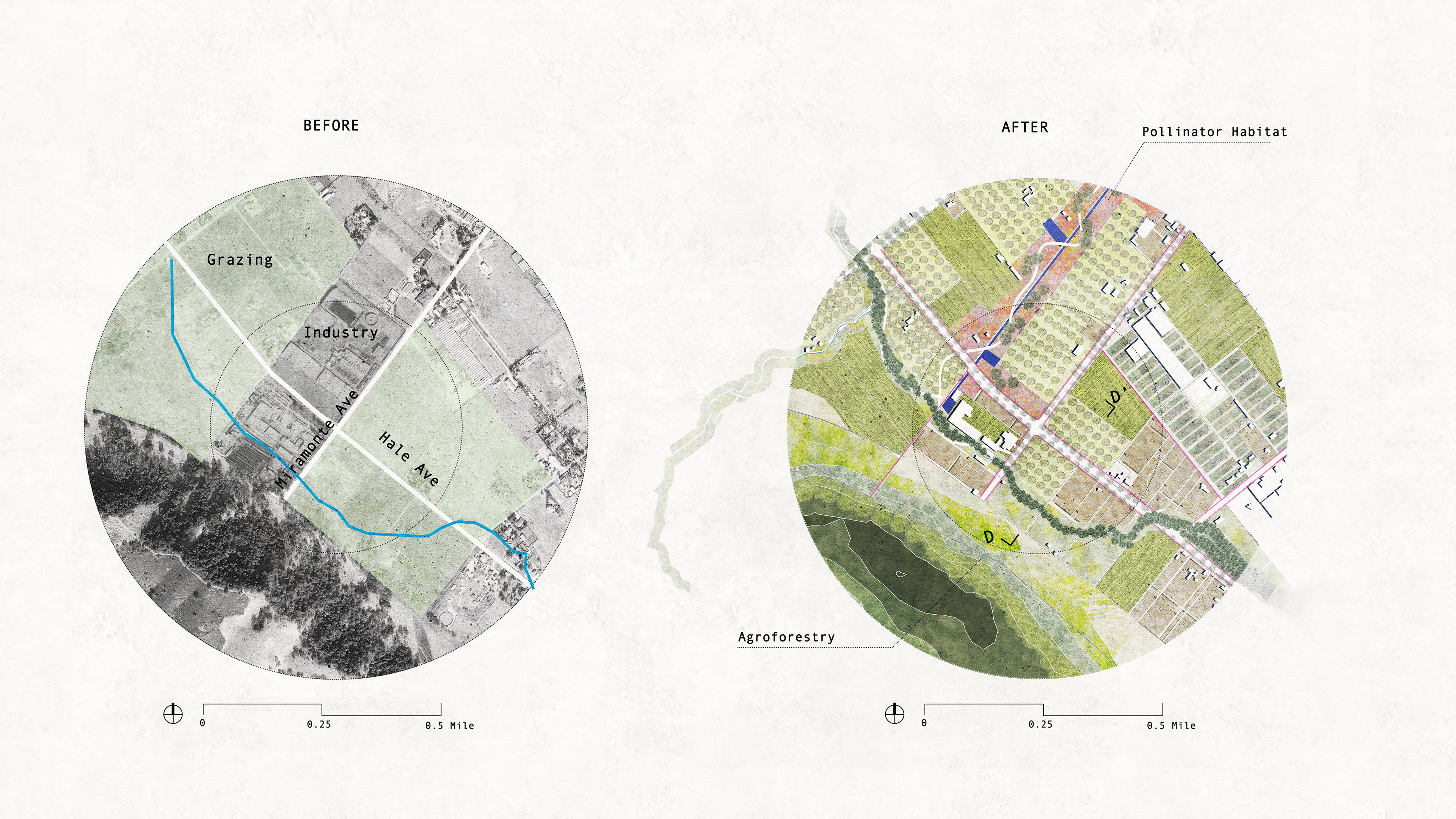
Detailed Plan -- Ag + Ecology

5. AG + Tourism
Coyote Ag Park
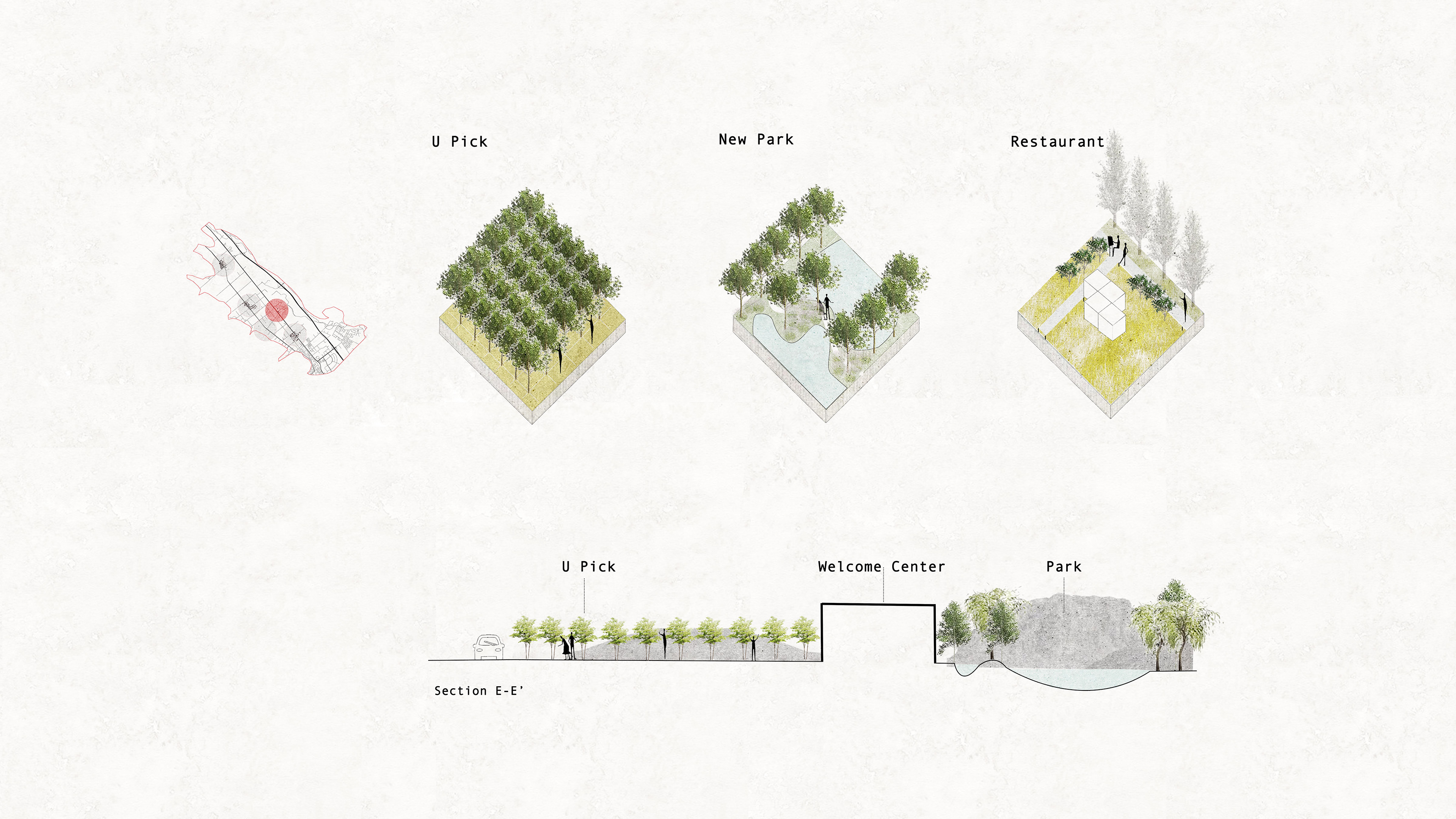
Tourism Productive Landscape

Detailed Plan -- Ag + Tourism
